A group of farmers and agribusinesses are taking a proactive approach in collecting long-term data to measure and monitor the impact of irrigation wells on surface water and groundwater.
Midwest Water Stewards is member-funded association of individual farms and agribusinesses that commissions Tritium Inc., a hydrogeologic consulting service led by Todd Feenstra, to maintain a network of almost 220 monitoring wells and measure more than 75 streams throughout Michigan’s Lower Peninsula and Northern Indiana. The association’s stated purposes are to collect extensive water data, build and improve predictive models, and educate.
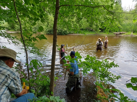
On June 22, Feenstra and his staff led a field day demonstration at one of the newest wells in the network in Mecosta County, Michigan on acres owned by Sandyland Farms, a chip potato and seed corn operation. Attendees included representatives from Michigan Farm Bureau, Michigan Water Use Advisory Council, Michigan Geological Survey, Michigan DNR, EGLE (Water Resource Division and Well Construction Unit), Michigan State Extension, as well as other consultants and growers.
Over a period of several hours, Feenstra demonstrated what, how, and why they collect stream measurements from nearby surface water resources – in this case, the Little Muskegon River. The participants used Tritium’s equipment to measure the streambed, the discharge, the water levels, and water temperatures. These factors, including the character of the streambed sediments, are keys in monitoring and measuring potential streamflow depletion from the irrigation well.
The surface water conditions are just one part of the monitoring program. Using the latest technology (pressure transducers, ultra-sonic meters, and software) Feenstra collects physical measurements of the groundwater resources in the area from dedicated monitoring wells and the associated center-pivot irrigation systems. The water level data is used to directly measure the drawdown is created by the irrigation well and, more importantly, how quickly the groundwater levels recover when pumping stops. Over the long term, the data clearly indicates the seasonal and year-to-year water level trends.
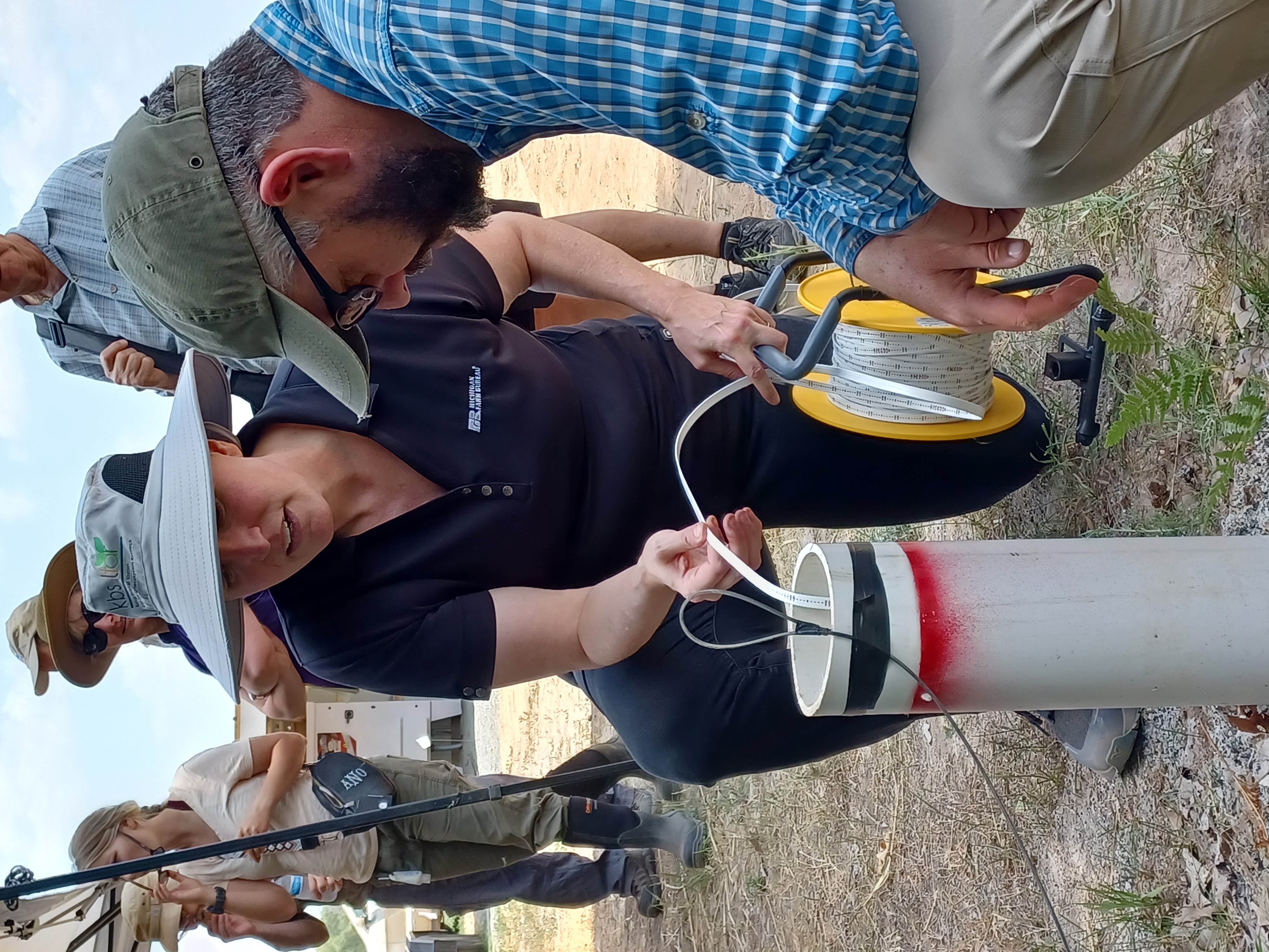
As a demonstration, the center pivot and the irrigation well were operated as normal for a period of two hours, irrigating a field of corn with 1,000 gallons of water per minute. The well logs showed that the irrigation and monitoring wells are 320 feet deep and that there are at least 7 geologic layers below the farm field. The attendees directly measured the drawdown and found that the groundwater level in the monitoring well (65 feet from the irrigation well) dropped about 1 foot. They also measured the recovery, and within 2 hours of shutting off the irrigation well the groundwater levels had already returned to pre-irrigation readings.
When questioned about the rapid recovery Feenstra referenced the well logs that reveal multiple, thick clay layers above the deep aquifer which is over 300 feet below the ground surface. He said it is very unlikely that Little Muskegon River is a source of water for the deep aquifer in this case. He also referenced the several months of groundwater monitoring in this region that clearly indicate that despite almost no precipitation in June, water levels have been largely consistent. How the deep aquifers are replenished so quickly with so little rainfall is likely a complex answer that we don’t fully understand – yet, Feenstra said.
Deeper aquifers beneath multiple layers of sand and clay can function very differently than aquifers at, or near, the ground surface. What water sources recharge the deep aquifers can be difficult to pinpoint. It is likely not a single source said Feenstra. Potential sources may include aquitards, other aquifers, surface water sources, groundwater storage, groundwater baseflow, and surface water bodies to name a few Feenstra continued. That complexity is multiplied by the seasonal and cyclical nature of the crop irrigation.
“In Michigan, on average, the growers irrigate about 30 days a year,” Feenstra said. “There are 335 days to recharge.” In addition, farmers only irrigate enough to give the crops “water they need and not a drop more,” Feenstra said. “We watch closely to ensure that groundwater levels do not continue to decline over time. Declining water levels indicate depletion and then there is cause for concern,” he added.
Potato Growers of Michigan was the first commodity group to get on board with the well monitoring program and help fund Midwest Water Stewards, Feenstra said. Up to that point the group was solely funded by individual growers who recognized that gathering in-depth long-term data was critical to do, even if it meant the farmers themselves had to help fund it.
“This data is important because we want to know that we’re being stewards for the land,” said Jim Casler, chief financial officer, Sandyland Farms.
Added Michigan Potato Industry Commission Executive Director Dr. Kelly Turner: “The state (of Michigan) isn’t doing this because they don’t have the resources to do it.”
Feenstra concluded that the meticulous sampling and data over the course of several years helps fill in knowledge gaps that ensure sustainable irrigation practices for the present and the future. “These data are all pieces to the puzzle, and the more pieces we have, the better we’re going to be able to manage and steward the water resources,” he said.
– By Zeke Jennings, marketing and communications manager for the Michigan Potato Industry Commission. He can be reached at zeke@mipotato.com.